Oceans may cover more than 70% of the Earth’s surface, but we have better maps of the moon than we do the seabed. There are good reasons for that: The ocean floor is obscured, and the harsh environment makes it hard to send humans down to get a closer look. But as robots improve, we may finally get a clearer picture of the deep abyss.
There are a number of startups racing to map the ocean in greater detail, but the latest to snag fresh funding is Bedrock Ocean, which recently closed a $25 million Series A-2 round led by Primary and Northzone, the company exclusively told TechCrunch. Autopilot, Costanoa Ventures, Harmony Partners, Katapult, and Mana Ventures participated.
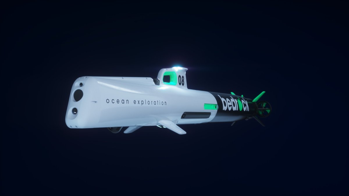
Bedrock Ocean has developed an autonomous underwater vehicle (AUV) that runs for up to 12 hours off its lithium-ion batteries while mapping the floor using its sonar and magnetic sensors.
Traditionally, the ocean floor has been mapped by large ships, which blast powerful sonar pulses down into the water column. Those ships slurp fuel and require human operators, making them costly to sail, and they disrupt marine life.
“The pot at the end of the rainbow that everybody has been chasing for 20 years has been, can we replace traditional ships?” Brandon Mah, COO of Bedrock Ocean, told TechCrunch.
Bedrock Ocean’s AUVs are still launched from a ship, but once underwater, they operate independently from it. Two of them can cover the same ground as one traditional mapping ship, and one 40-foot ship could carry 10 to 12 of the AUVs, he said.
Bedrock designs and builds its own AUVs, which Mah said cost less than $1 million apiece. The company also developed its own software both to operate the AUVs and to perform the mapping. The AUVs store data locally and perform some processing on board. When it’s time to transmit, they surface and send the data to the ship via Wi-Fi. A Starlink antenna aboard the ship can then beam that information to the cloud, where observers can keep an eye on things.
“We can confirm that the data is of the quality that we’re targeting, as well as identify potential targets that we want to investigate further in near real time,” Mah said.
The subs sail five to 10 meters above the seafloor, allowing the AUVs to use less powerful sonar than ship-based mapping would. Mah said that Bedrock’s sonar poses less harm to marine mammals because its frequency is outside the audible range, uses less power, and is deployed closer to the seafloor, meaning the animals are less likely to be swimming in the sonar’s path.
Bedrock can place items on the ocean floor with an accuracy of one to two meters. That’s below the sub-meter accuracy ship-based surveys can deliver, and it’s because the AUVs lose GPS signals after they dive. To determine their position underwater, they rely on inertial navigation, which isn’t as accurate as GPS.
Mah argues that not every survey needs sub-meter accuracy, but that many operations on the seafloor would benefit from faster mapping. Offshore wind developers might pay for a sub-meter survey up front, but then when it comes time to build, there might be areas where two-meter accuracy is enough.
The startup has spent the last two quarters doing paid survey work for offshore wind, oil and gas, and environmental assessments. The speed of the assessments, and the ability to view the data quickly, has also caught the attention of the U.S. Navy. “We showed off that capability,” Mah said. “They were kind of blown away.”
Update 7 pm ET: Brandon Mah is COO of Bedrock Ocean, not CEO as previously stated.